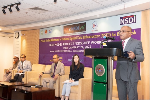
A kick-off workshop on National Spatial Data Infrastructure Utilization Model Projects (NSDI-MPs), co-organized by Survey of Bangladesh (SoB) and Japan International Cooperation Agency (JICA), was held on the 24th of January 2023 at Multipurpose Hall, Bangabandhu Military Museum, Dhaka. A total of about 60 participants from the Working Group (WG) members of NSDI took part in the workshop. The main objective of the workshop was to disseminate information about implementation plan of NSDI-MPs with the NSDI Working Group Members (WGMs) and officially launch the NSDI-MPs. At the workshop, Brig. Gen. Md. Habibul Huq, the Surveyor General, greeted the participants and asked everyone involved in the NSDI to share their data and to absorb everything possible at the kick-off session to make it worthwhile. Col. Mohammad Shahidul Islam, MoD asked SoB to act as a coordinating agency and establish a strong collaborative relationship among all stakeholders. At the workshop, Takaki Okatani, JICA
ief Advisor presented about 'Key achievements and challenges of NSDI'; Md. Saidus Jaman, NSDI Project Manager talked out 'Past activities and future plan of NSDI'; Mohammad Amanul Islam, Consultant (System Engineer) NSDI Portal Development presented about 'Development of NSDI Portal: achievements, future plans and challenges'; Hiroto Fujita, JICA Expert and Team Leader talked about 'Concept and implementation plan of NSDI-MPs'; Damodar Lamsal, JICA Expert highlighted the program; Shunsuke Tomimura, JICA Expert presented about 'Applicability of Science, Technology and Innovation (STI) in the context of NSDI-MPs'; Tomohiko Hatori, JICA Expert talked about 'Data selection based on the results of quantitative data quality evaluation'. All the three (3) NSDI-MP thematic groups presented their implementation plans at the workshop, incorporating the information about background, goal and objectives, project area, project members and their responsibility, components and work schedule, input
data, equipment and software, workflow, quality control plan/measures, data product specification creation plan/measures, deliverables, and challenges and recommendation of the model project etc. Dr. Farida Perveen, DAE (Leader, Agriculture Management) presented their Implementation Plan on 'Rice Area Mapping of Manikganj Sadar Upazila using Medium Resolution Satellite Image'; Syed Nazrul Islam, GSB (Leader, Disaster Management) presented their Implementation Plan on 'Surface and Sub-surface Characterization of Purbachal Town, Dhaka for Seismically Hazardous Zone (Microzonation) Identification' and Md Shahidullah, BNHOC, (Leader, Water Management) presented their Implementation Plan on 'Feasibility Study of Circular Waterways around the Dhaka City'. In his closing remarks, Md. Abul Kalam, the Project Director of NSDI thanked everyone who worked hard to make the event successful. Likewise, in her closing remarks, Ms. Chinatsu Iha, JICA Bangladesh Office Rpresentative, humbly reques
ed three team leaders for the successful implementation of the NSDI-MPs and also expressed that the most important aspect was to explore and cultivate the potential of the NSDI user base and to understand the benefits of NSDI and to try to demonstrate it.